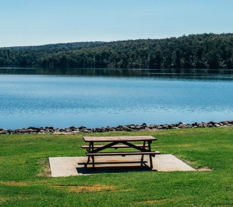
Looking for information on recreation facilities at Blue Rock Lake?
-
Why does a storage sometimes show as more than 100% full
Sometimes our storages show as a little bit more than 100% full.
This happens when the reservoir is already 100% full, and water flows into the reservoir faster than it is being released. The dam cannot permanently retain this additional water as it is above the spilling point, but temporarily ponds it until water flowing in slows to a point where releases are higher, and the reservoir returns to a normal level.During this period, the storage shows as slightly more than 100% full.
All of our dams have been designed to cope with this temporary ponding.
-
History
The reservoir’s construction began in 1979 and was complete in 1984. It has a capacity of 198,280 megalitres (ML).
Following construction of the dam, the safe yield of the Latrobe River system upstream of the Morwell River Junction was increased to 325,000 megalitres per annum.
The embankment of the dam is constructed from earth and rock fill material.
-
Purpose
With its rich reserves of brown coal, the Latrobe Valley generates 85% of Victoria’s electrical power and continues to be a vital base for the State’s economic growth. To meet the planned industrial expansion in the region, an assured supply of water is essential to meet industrial, private irrigation and domestic water requirements.
The Latrobe Valley electricity generating companies are able to extract 150,000 megalitres per annum of yield from Blue Rock, for use as cooling water in existing power stations and for future power generation expansion.
Gippsland Water, which is the urban water corporation for the Latrobe Valley, is able to draw 14,000 megalitres annually from Blue Rock to supplement Moondarra Reservoir.
Gippsland Water also pumps water from the Tanjil River to the township of Moe.
Water drawn from the storage is available to maintain minimum flows in the Latrobe River during periods of naturally low flows as required by the State Environment Protection Policy.
-
Statistics
RESERVOIR Capacity 198,280 ML Dead storage 1,000 MLL Surface area 873 ha Full supply level 140m AHD Catchment area 360 km2 EMBANKMENT Maximum height 72 m Length (Excluding Spillway) 72 m SPILLWAY Crest length 41.5 m Discharge capacity 100,000 ML per day
-
Power Generation
In 1992 Pacific Energy installed a small hydroelectric generator at Blue Rock Lake that gives a total capacity of 2.4 megawatts of power into the state network.
For more information please visit Pacific Energy.
-
SRW's role during floods in the Latrobe System - Blue Rock
Water storages in the area are not designed so that Southern Rural Water can actively manage floods.
Southern Rural Water helps to provide river flow information during floods.
Please keep clear of dams and spillways during floods.The Latrobe System has two storages managed by Southern Rural Water:
• Blue Rock Lake, which has a capacity 198,280 megalitres (ML)
• Lake Narracan, which has a capacity of 7,230 MLTheir purpose is to store water for various uses – power generation, industrial, urban and irrigation purposes, as well as storing water for the environment.
When the storages were designed, they were not intended to allow Southern Rural Water to significantly influence releases in times of flood.
Blue Rock Lake has an ungated spillway, and the valves available to release water from the storage are very small compared to the flows into the dam during heavy rain. The spillway is set at a fixed level and once the storage fills to this level, water begins to flow over the spillway.
Lake Narracan stores a very small volume of water compared to its large catchment. Even if it was empty at the start of a flood, it would quickly fill up and releases from the dam would need to match the flows into it. Southern Rural Water must operate Lake Narracan in times of flood to ensure that it remains in a safe condition.
Blue Rock Lake operations during floods
During floods, Southern Rural Water inspects the dam regularly to ensure it remains in good condition, and also monitors flows into and out of the dam.
We provide advice to the Bureau of Meteorology and the SES if flows out of the dam are likely to exceed the flood warning triggers at Tanjil South, downstream of the dam.
Despite the fact that we have little ability to control releases from the storage, the peak rate of flow from the dam is significantly less than the peak rate of inflow during floods.
This is because the spillway of the dam is relatively small, and limits the amount of water released during floods. The large surface area of the lake allows excess water to safely pool behind the dam embankment (also known as surcharging) while it waits to be released through the spillway.
As an example, in 2011 the lake was full at the start of a flood. Flows into the lake peaked at about 6,000 ML/d. The flow out of the dam peaked at about 2,850 ML/d, or about half of the inflow.
This means that, compared to when there was no dam at the site, the severity of flooding downstream is significantly reduced.
In this case, the ability to reduce the severity of downstream flooding was built into the dam design, rather than any Southern Rural Water action during floods.
Operating Lake Narracan during floods
Lake Narracan has a gated spillway with four flood gates designed to pass water underneath, allowing us to maintain the storage at a specific operating level.
Despite the presence of the spillway gates, the amounts released are governed almost entirely by the flows into the storage. This is because Lake Narracan’s storage volume is tiny in comparison to its catchment size.
During floods, Southern Rural Water regularly inspects the condition of the dam to ensure it remains safe and fit for purpose. Rainfall and river flows into the dam are carefully monitored so we can make decisions about releases from the dam.
We provide advice to the Bureau of Meteorology and the SES if outflows are likely to exceed the flood warning triggers at Thom’s Bridge and Rosedale, downstream of the dam.
As a comparison, the storage at Lake Narracan is less than 1% of that held by Thomson Dam but its catchment is about four times larger.
Any spare storage capacity will be filled within hours, and so releases from the dam in times of flood need to closely match the flows into it.
Flow information
When we know high rainfall is possible, our staff work closely with other agencies such as the SES, local councils and the Bureau of Meteorology to provide information on the flows passing through our dams during floods.
We provide daily updates about the water levels in local storages on our homepage and individual storage pages. We also provide links to Bureau rainfall forecasts, flood warnings, river levels and emergency assistance provided by the SES, on our Flood page.
Keep clear of our dams
During high river flows we urge all visitors to stay well away from our dams, especially the spillways or other release points, and the downstream water course.
Please:
• follow any requests from Southern Rural Water staff
• take note of signage and fencing, and
• stay away from any prohibited areas, particularly the dam walls and spillways.
Playing on or near a spillway during a flood is a recipe for disaster.
We strongly recommend that if you are in a flood prone area that you and your family familiarise yourself with the SES’s Flood Safe information on their website https://www.ses.vic.gov.au/plan-and-stay-safe/emergencies/flood
More information
For more information contact us on 1300 139 510.
Location
The Blue Rock Dam and Lake are located on the Tanjil River in West Gippsland – VicRoads Reference Map 97 E3